Work

Montage of the Quake Nation interactive. Installed as part of the Whakarūaumoko Active Land exhibition in the Te Taiao Nature zone.

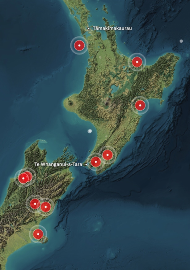
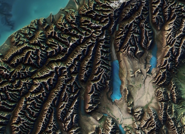
Map of Aotearoa New Zealand. Topographical data from Geographx was combined with seafloor maps from NIWA by Lachie Philipson & Robin Marshall.

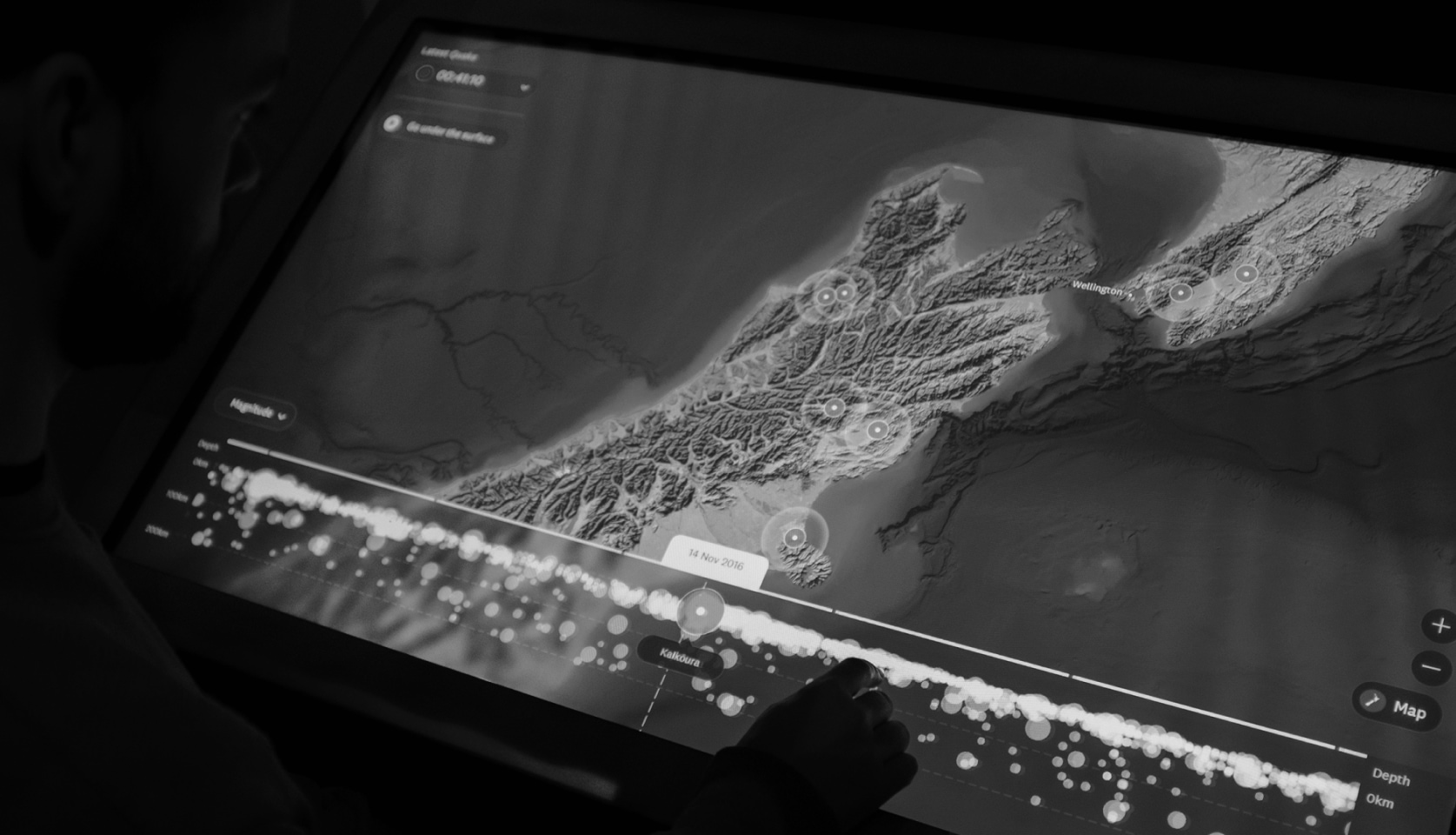
Photo of the Quake Nation interactive in use.

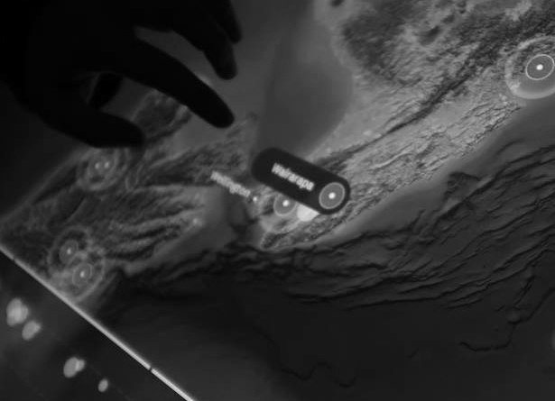
Location Labels (Te Reo Māori)

Location Labels (Photo)

Earthquake Timeline (UI)

Kaikōura Earthquake (UI)

Earthquake Timeline (Photo)

Installation

North Island Earthquakes (UI)

Montage (UI)

Montage (Photos)
Process

Lachie visiting the installation to oversee user testing.

An early prototype of the timeline UI.

Images from the map production in GDAL (Geospatial Data Abstraction Library).
⌙ Top left: topographic map supplied by Geographx.
⌙ Top right:
bathymetry supplied by NIWA.
⌙ Bottom left: Hillshade layer.
⌙ Bottom right: Recoloured bathymetry layer.

Closeup of the raised-relief render.

UI tests of the earthquake epicentre.

UI tests of the earthquake data.

UI tests of the 3D data mode.

Accessiblity colour tests for earthquake labels.

Earthquake data animation tests.

An early prototype of the UI for testing.

Testing the timeline density with earthquake data.

An early UI concept design.

Testing the legibility of the earthquake sensors label.

A screenshot of an early prototype with earthquake data.

Various earthquake label UI tests and iterations.

Montage of photos and prototype UI designs from the Quake Nation process.
Information
The Museum of New Zealand Te Papa Tongarewa is our country’s national museum. Commonly referred to as Te Papa (Māori
for “the treasure box”), the museum is visited by more than 1.5 million people every year amd is located in Te Whanganui-a-Tara/Wellington.
Te Papa was opened in 1998 after the merging of the National Museum and the National Art Gallery.
In 2019, the team at Springload created Quake Nation, a live data-driven visualisation displaying over 200 years of earthquake data in New Zealand. The installation is part of the new Whakarūaumoko Active Land exhibition in the Te Taiao Nature zone.
The map displays all earthquake locations and their magnitude across New Zealand as well as major events such as the Christchurch Earthquake with stories and news about the natural disaster. Earthquakes appear on the map as visitors scroll the timeline and clusters indicate multiple earthquakes, making it easy to see our most seismically active fault lines.
The team composited multiple different map data sources and transformed them into a single topographic projection using the geo-spatial software, GDAL (Geospatial Data Abstraction Library). The end result is a visually rich, but geospatially correct, layered rendering of New Zealand. Topographical data was sourced from cartography studio Geographx, and seafloor data from Crown Research Institute NIWA. The NIWA seafloor map was re-coloured to look more like a satellite image while still allowing users to see terrain and fault lines.
In close collaboration with GNS Science, the team built upon Te Papa’s initial concept through in-depth prototyping using the extensive GeoNet earthquake data set from the beginning of the design process. The creation of a scrollable timeline lets users explore the entire GeoNet earthquake dataset back to 1810 as well as intergrateing with the GeoNet API feeds to present live data every few minutes, including alerts when the latest earthquake above a specific magnitude is detected.
“In our observational research of visitor use of the interactive, we observed that of the visitors who came within proximity of Quake Nation, over 40% engage. This is an excellent conversion rate for a touchscreen interactive in an exhibition of this kind.”
— Amos Mann (Digital Producer, Te Papa)
This project was recognised with a prestigious spatial excellence award from the New Zealand Cartographic Society, which was particularly meaningful as it acknowledged the quality of the mapping, not just the design of the interactive.
Credits
- Amos Mann, Kate Whitley, Ralph Upton (Client)
- Dan Newman, Lachie Philipson, Josh Twaddle (Design)
- Lauren Skogstad, Lachie Philipson (Research)
-
Joris Rotteveel, Robin Marshall, Cameron Bourgeois, Lydie Danet, Alexandr Haleisha,
Sofia Spials, John Anderson, Daniel Kohn, Eugene Dementiev, Jan Nakladal (Development) - GNS Science, Geographx (Collaborators)
Awards / Recognition
- New Zealand Cartographic Society Award for Best Map Design (2019)
- AGDA Awards: Merit, Digital / Kiosk (2019)
- DINZ Best Awards: Finalist, Digital Products (2019)
- DINZ Best Awards: Finalist, User Experience (2019)
Featured
He Iwi Rū | Quake Nation: effective interactive data visualisation in the museum (2021)
⌙ Michael Upchurch (Author)